Workshop 2 and related engagement
Overview
On July 17, 2024, Sound Transit, in partnership with the City of Seattle and King County, hosted the second workshop of the South Downtown Hub plan. This workshop was part of a series focused on developing concepts for improvements to streets and public spaces in South Downtown. Workshop 2 focused on public spaces and potential transit-oriented development at and around existing and potential future transit stations in these neighborhoods. The goal in this second workshop was to share and collaborate on concepts with the community that represent different levels of change, all aimed at supporting active, affordable, and equitable spaces for the community.
Sound Transit and its partners also launched an exhibition alongside Workshop 2, summarizing feedback from Workshop 1 and earlier engagement. The exhibition highlighted strong community support for transformative options that reclaim roadway space for pedestrians and public spaces, as well as analysis to address concerns about how changes could impact traffic patterns throughout the Chinatown-International District (CID) and Pioneer Square neighborhoods. The exhibition was on display and open to the public through the end of 2024 in Union Station’s Great Hall.
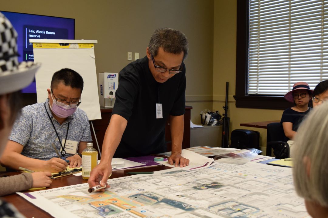
More than 85 community members participated in an interactive and facilitated small-group activity during Workshop 2, which used transparency overlays of street and infrastructure concepts, along with photo cards, to depict urban design features and amenities. Similar to the first workshop held near the beginning of 2024, staff introduced multiple options and helped participants visualize and navigate the benefits and challenges of each. Participants then created vision boards for three focus areas. Notetakers captured feedback, questions, and general sentiment throughout the exercise. Community feedback from the workshop informed the further study and materials presented in following engagement. Community members participated in English, Cantonese, and Mandarin-facilitated conversations. Staff also had Vietnamese interpreters available.
To reach those that weren’t able to attend the workshop, the vision board activity was shared through an online survey offering an additional opportunity for community input on the South Downtown Hub Plan. Additionally, Sound Transit and the City of Seattle staff met with over 50 community members through several small, focused forums. Participants included CID and Pioneer Square residents, seniors, workers, and community members. The goal was to bring the workshop activity to the community, collecting feedback from those who have specialized connections and interests within the CID, Pioneer Square, and surrounding neighborhoods.
The feedback shared at the workshop, forums, and online survey continues to inform priorities for public spaces, adaptive reuse of historic buildings, and potential new transit-oriented development in South Downtown.
A summary of feedback
- Prioritization of pedestrian and bicycles safety, movement, and overall experience. This could include pedestrian- and bicycle-only streets, wayfinding, lighting, and hill climbs with ramps and stairs on steep slopes.
- Support for improved connections from the south CID area to the existing CID light rail station.
- Interest in pop-up events and immediate activation of public spaces within Union Station.
- Request for more green spaces, including parks, gardens, and planters throughout CID and Midtown.
- Interest in new development in CID and Midtown, including residential housing, office space, retail, and hotels.
Workshop focus areas
The focus areas of key streets and public spaces that were discussed to reveal how best to connect neighborhoods and the sites of existing and potential future transit stations included:
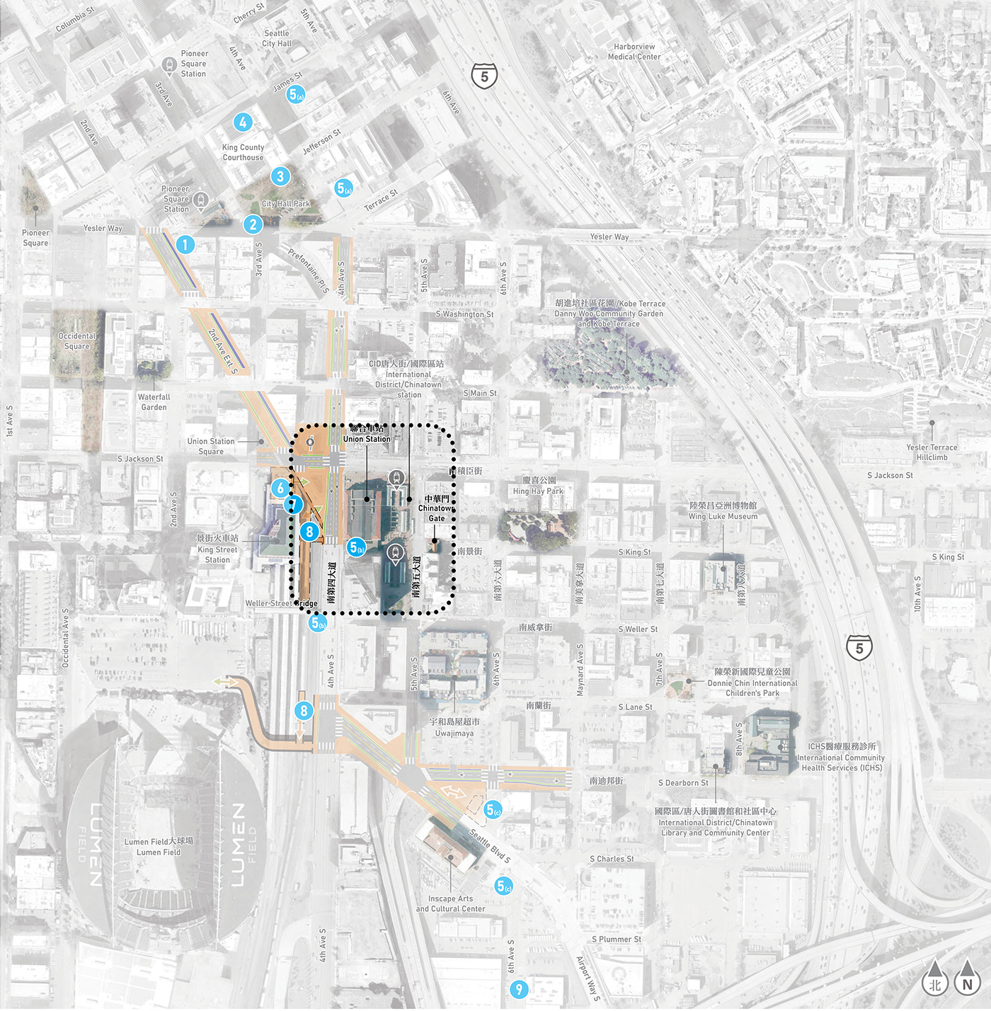
The busy intersection of 4th Avenue South, 2nd Avenue Extension South, and South Jackson Street is at the heart of a busy transportation hub. It is between active regional and intercity rail service at King Street Station as well as light rail service at the existing International District/Chinatown Station adjacent to the historic Union Station. A number of barriers for rolling and walking between the CID and Pioneer Square neighborhoods exist in this area due to the intersection of major roadways and regional freight and passenger rail.
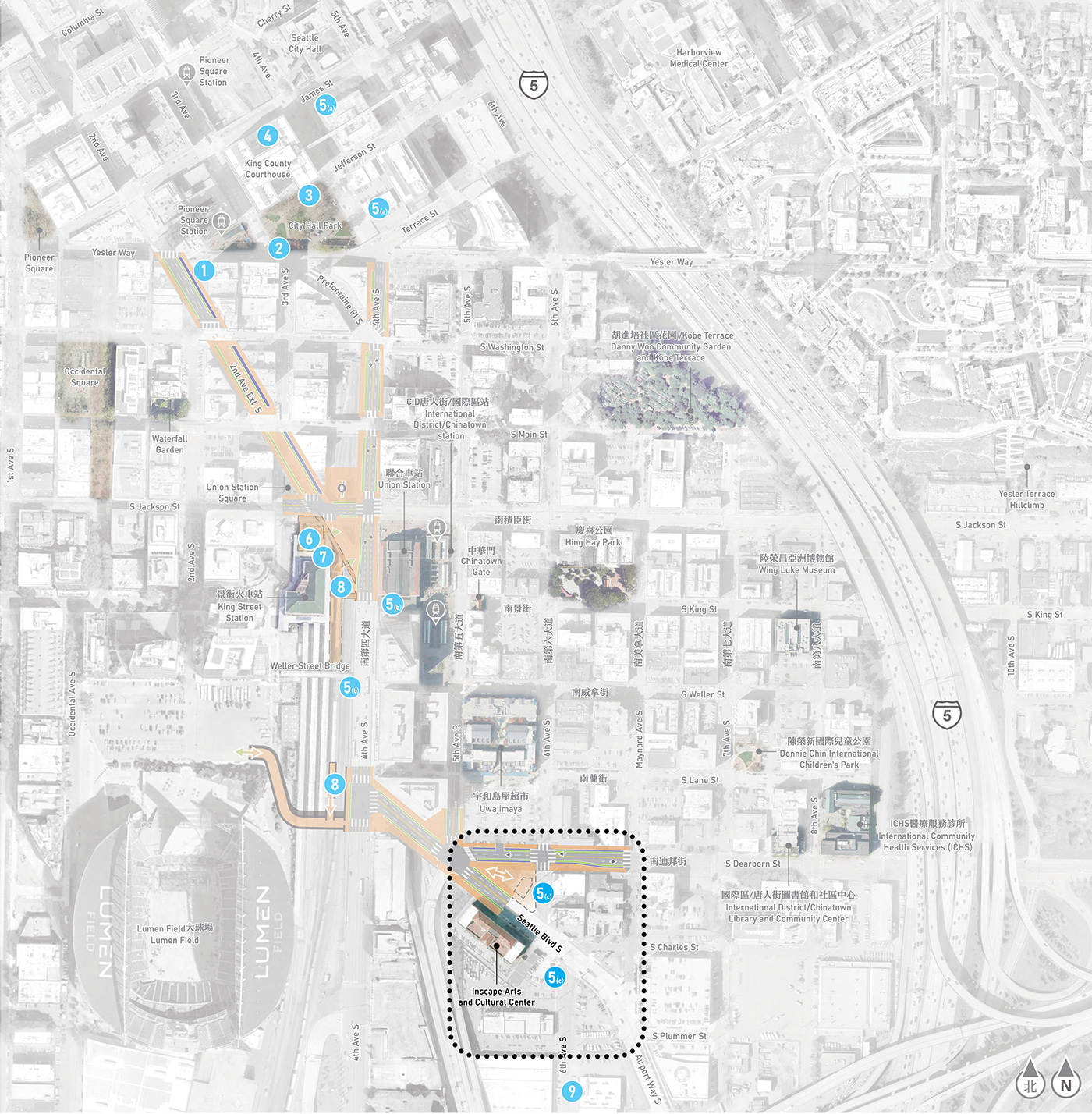
Three blocks south of Union Station, South Dearborn Street, and Seattle Boulevard have long felt like a barrier at the south end of the CID, perceived as unsafe and unwelcoming for pedestrians due to arterial streets and auto-centric infrastructure. Home to the INSCAPE Arts and Cultural Center and part of the International Special Review District, this area is being considered a potential site for a new light rail station.
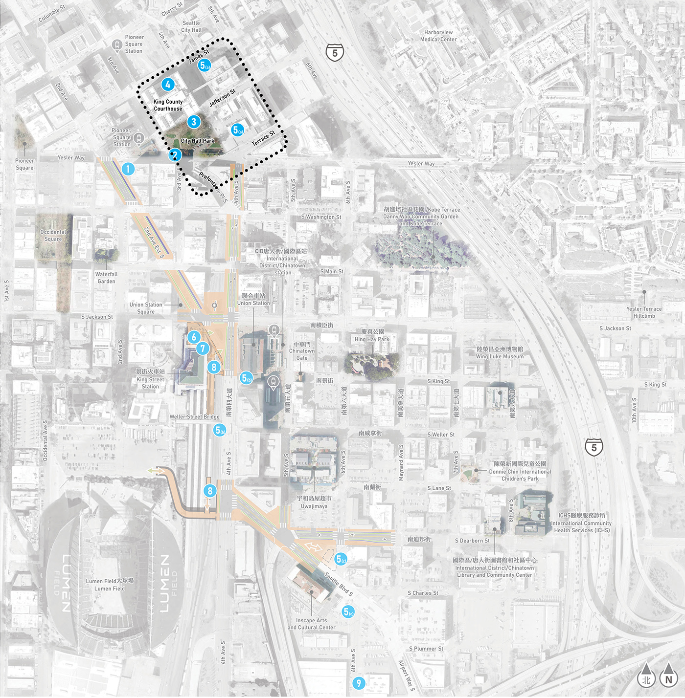
Three blocks north of Union Station sits the historic City Hall Park and King County’s Civic Campus, an underutilized area in Pioneer Square poised for reimagining and redevelopment.
All three of these areas are considered together as part of a comprehensive improvement package. Improvements to connection and activation can benefit communities and regional access to the neighborhoods now. The following summarizes the workshop activity and community input related to each focus area.
The focus at this location is to bridge physical barriers between these two transit centers and complement that with greater community use of Union Station and surrounding plazas. We are also exploring ways to bridge physical barriers between the CID and Pioneer Square neighborhoods.
Workshop, forum, and survey participants considered ways these public spaces could be improved to better serve and connect these historic neighborhoods.
A summary of feedback
- Strong support for the Union Station option that would transform Union Station into a space with public and community-serving uses on lower levels and Concourse. The community also supports improvements to existing station plazas, including reconfiguring openings, removing and replacing canopies, upgrading paving, and planters that complement activation and circulation.
- Interest in opening Union Station to the public and community organizations for indoor gatherings, events and performances, childcare, storage, and other community activities. Specific ideas included dance classes, tai chi, and games such as mahjong.
- Concerns about how this area is being developed arose, especially around new development that might conflict with existing businesses. Community members suggested adding new businesses that support and enhance existing businesses, as well as art and pedestrian features that uphold the culture of the neighborhood.
- Support for a café and food kiosks in Union Station to encourage its use as a public space and create a community hub.
- Prioritization of safe, multi-modal connections and plazas that are enhanced by lighting, wayfinding, trees and planters, and art.
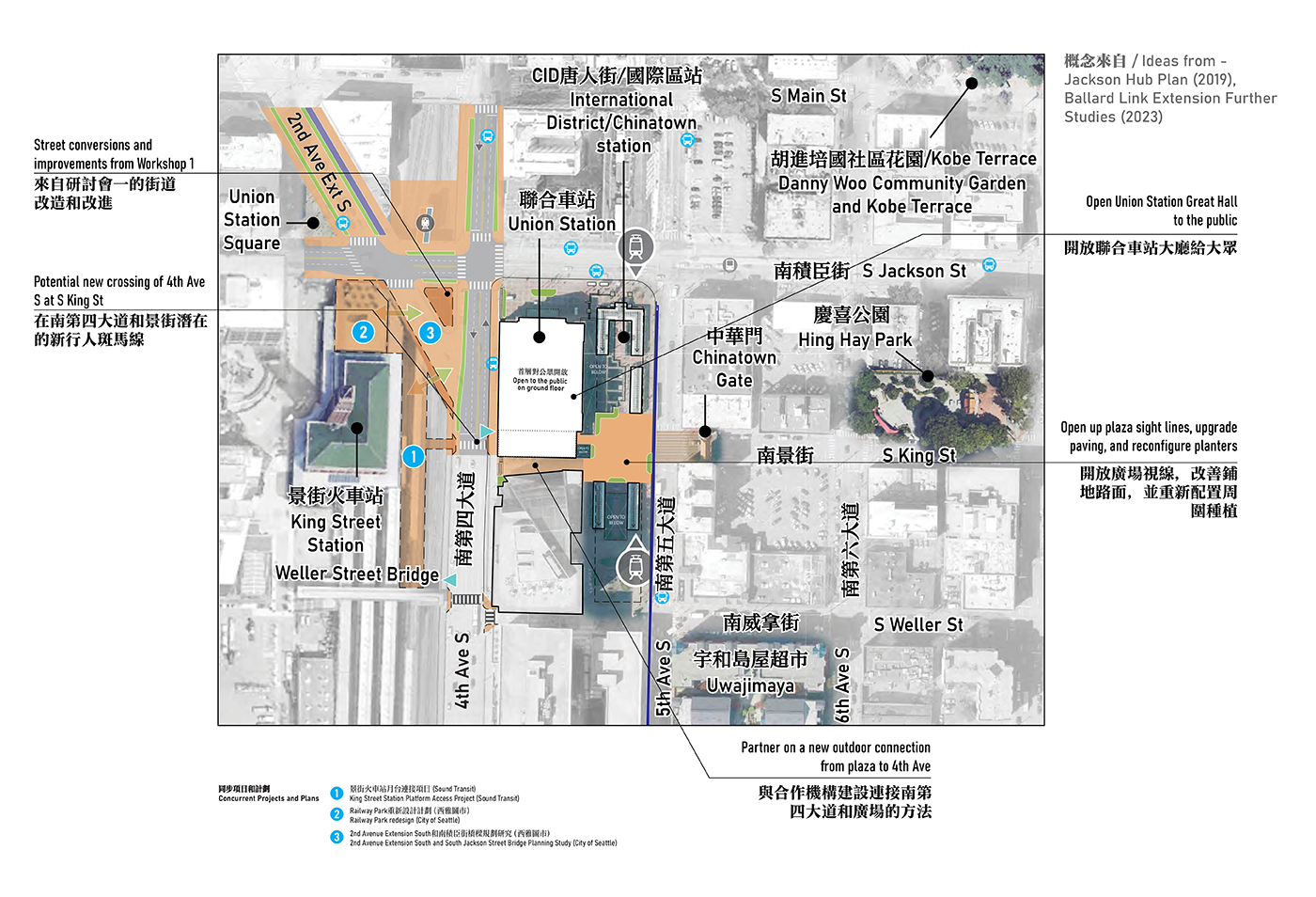
Focuses improvements to existing station plaza on S King St, opening up sight lines, improving walking surfaces, and reconfiguring planters. Added mid-block public connection from plaza to 4th Ave S in partnership with private property owners.
Union Station Great Hall could be opened to the public for use by community-based organizations.
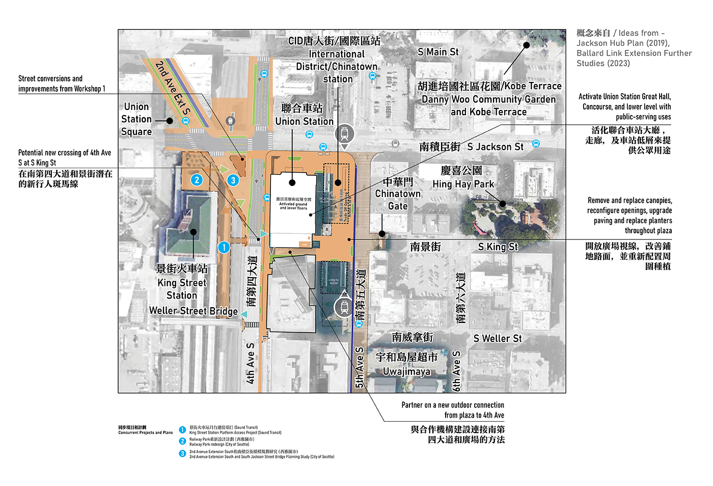
Expands improvements to existing station plazas, including configuring openings, removing and replacing canopies, upgrading paving, and planters that support activation and circulation. Includes mid-block public connection from plaza to 4th Ave S in partnership.
This could include further activation of Union Station with public and community-serving uses on lower levels and in the south “Concourse” of the building, though this would be different with the 4th Ave station alternative, which uses the concourse behind Union Station as the principal entrance lobby and vertical circulation zone.
The focus in this area was to think about different approaches to development surrounding a potential new light rail station near the INSCAPE Arts and Cultural Center. Participants considered priorities, including what uses to prioritize, level of density, and connections to public space. A new light rail station could serve as a catalyst for community development, public space for the neighborhood, and growing the community without displacing existing residents and businesses.
Workshop, forum, and survey participants considered ways to create new public spaces and connections between neighborhoods, transit services, and regional event destinations.
A summary of feedback
- Support for realigning streets to calm traffic and create more room for public space south of S Dearborn St and Seattle Blvd S.
- Concerns about pedestrian and bicycle connections from this area to existing transit stations. Interest in improving connections, wayfinding, and safety along S Dearborn St and Seattle Blvd S.
- Support for transit-oriented development that would include a mix of buildings, with prioritization of affordable housing and community-led development. Specific ideas included a pharmacy, post office, and retail.
- Interest in adding green spaces, including parks and gardens in the south CID area.

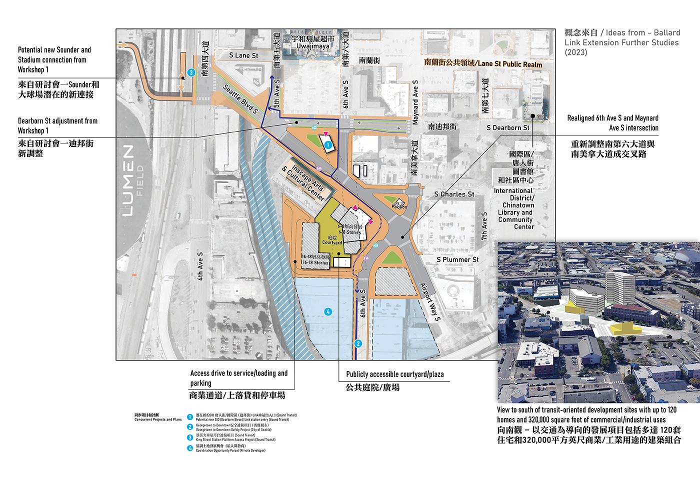
Realigns 6th Ave S to intersect with Maynard Ave S.
Transit-oriented development includes a mix of buildings that, with land use changes, could potentially include up to 120 homes and 320,000 square feet of commercial/industrial uses, framing a potentially publicly accessible courtyard/plaza.
Expanded sidewalks around station entrances on Seattle Blvd.
6th Ave S includes a shared-use path connecting to Georgetown to Downtown Trail planned by SDOT.
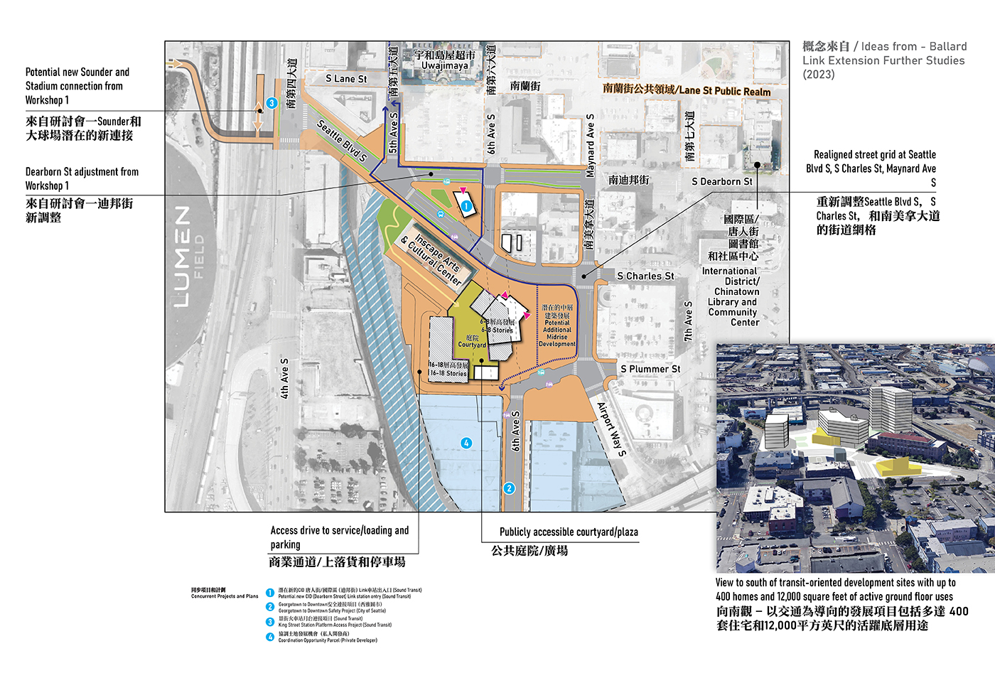
Realigns street grid to calm traffic and create more room for public space or additional development near station entrance.
Transit-oriented development includes a mix of buildings that, with zoning changes, could include at least 400 homes and 12,000 square feet of active ground floor use, framing a potentially publicly accessible courtyard/plaza.
Potential to partner with adjacent property owners on a grand public connection to INSCAPE Arts site.
The focus in this area was to explore different approaches to development surrounding a potential new light rail station near Seattle City Hall and King County Courthouse. Key considerations included what uses to prioritize, level of density, and connections to public space. Transit-oriented development such as housing, retail, cultural uses, and green space could reinvigorate underutilized buildings and spaces.
Workshop, forum, and survey participants considered ways to improve and expand existing public spaces and introduce residential transit-oriented development to support a vibrant, accessible, and inclusive neighborhood.
A summary of feedback
- Interest in mixed-use development featuring affordable housing and office spaces. Most supported increasing the density of development in the area.
- Concerns about tall building height and aesthetic of new development. Most supported mid-size buildings under 100 stories tall.
- Strong support for improving walkability, including space for an exterior hill climb and deeper pedestrianization of nearby streets.
- Interest in increasing public green spaces and parks in the area and adding green features to an exterior hill climb with stairs and ramps.
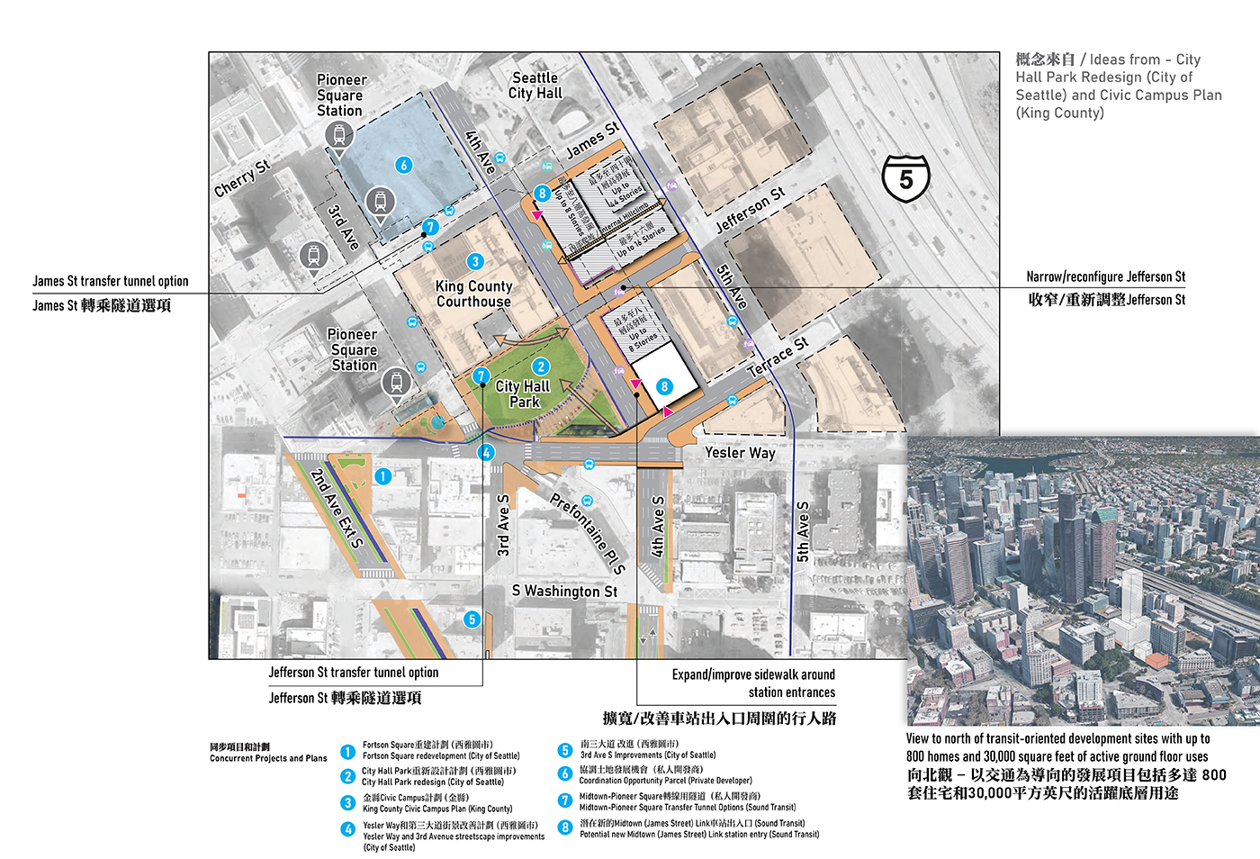
Complements City of Seattle plans for City Hall Park.
Transit-oriented development includes a mix of high- and mid-rise buildings that could include up to 800 homes and 30,000 square feet of active ground floor use.
Expands sidewalks around station entrances on 4th Ave, Jefferson St, and Terrace St.
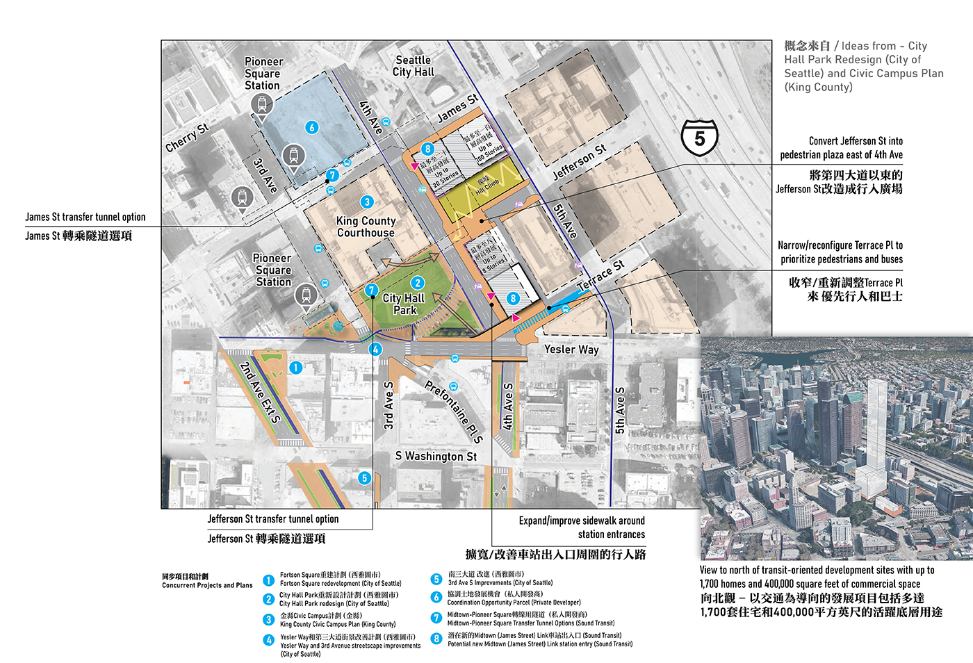
Transit-oriented development includes taller buildings that could include up to 1,700 homes and 400,000 square feet of commercial uses, along with public hill climb.
Narrowing of Terrace St, and pedestrian plaza conversion of Jefferson St east of 4th Ave.
Workshop 2 materials
- South Downtown Hub Workshop 2 Activity Guide:
[English + Traditional Chinese]
[Simplified Chinese]
[Vietnamese] - South Downtown Hub Workshop 2 presentation:
[English]
[Traditional Chinese]
[Simplified Chinese]
[Vietnamese]