Framework plan and related engagement
South Downtown Hub Framework Plan
Based on what we heard through community engagement and interagency coordination, 26 unique projects were identified as part of an overall vision in the South Downtown Hub (SDH) framework plan. A phased implementation approach - with project timing of less than 5 years, 5 to 15 years, or more than 15 years - was also developed based on project prioritization and funding. More details about the SDH process, potential project leads, and concepts can be found in the final South Downtown Hub framework plan.
An overview of projects across the four geographic focus areas – stitch, central, south, and north – follows.
Quick Wins: Next 5 years
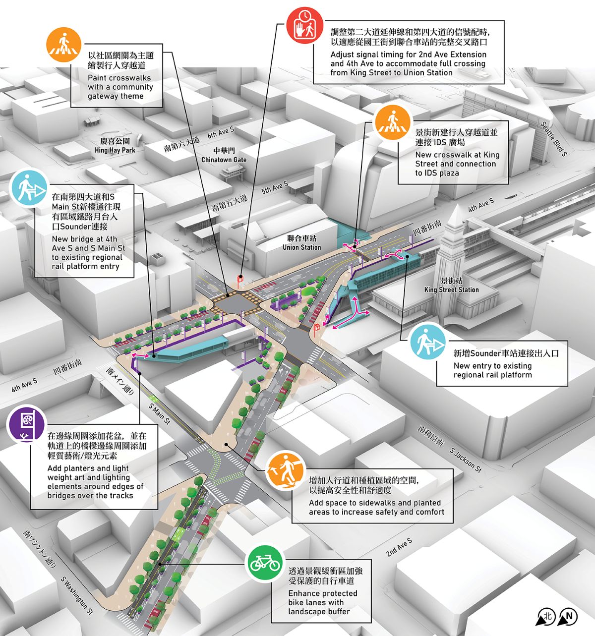
- Community crosswalks: Widen and pattern the crosswalks with decorative design reflective of the CID and Pioneer Square communities while improving visibility at the area's most used transfer point.
- Near-term street improvements: Add lightweight planters, lighting, and art along the bridge edges spanning the BNSF railway to cue a cared-for environment and soften hardscape.
- Pedestrian signal improvements: Adjust signal timing to enable reduced delay for pedestrian crossings between King Street Station and Union Station.
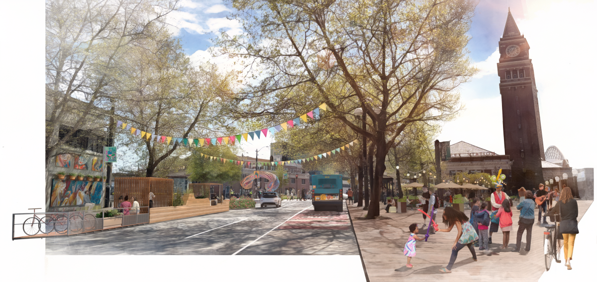
- 2nd Ave Ext S renovation phase 1: Develop curb and sidewalk extensions, street rechannelization and streetscape enhancements; introduce protected space for people biking and widen sidewalks while keeping necessary bus and vehicle movements.
Concurrent with Future SDOT and Sound Transit Projects: 5 to 15 years
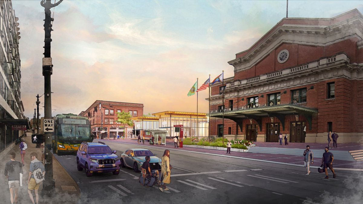
- 2nd Ave Ext S renovation phase 2: Extend the street and sidewalk improvements from phase 1 northward and rebuild the Union Station Plaza / 3rd Ave S frontage to improve pedestrian space and station area circulation, and integrate new bike facilities and plaza treatments.
- Local bike connection to King Street Station: Repave, adjust vehicle lanes, and create a bike facility connecting the bike lanes to King Street Station via S Main St, 2nd Ave Ext S, and S King St.
- 4th Ave S improvements: Add curb extensions, vehicle lane adjustments, and bike connections tying Main St bike lanes to the network north of S Washington St.
Future Major Capital Programs or Developments: 15 or more years
- 2nd Ave Ext S and S Jackson St rebuild: Implement permanent street upgrades as part of Seattle Department of Transportation's eventual rehabilitation or replacement of the 2nd Ave S Ext and Jackson bridge structures.
- Sounder north access retrofit: Create a new bridge connection from 4th Ave S and S Main St to the existing Sounder entry stair north of S Jackson St.
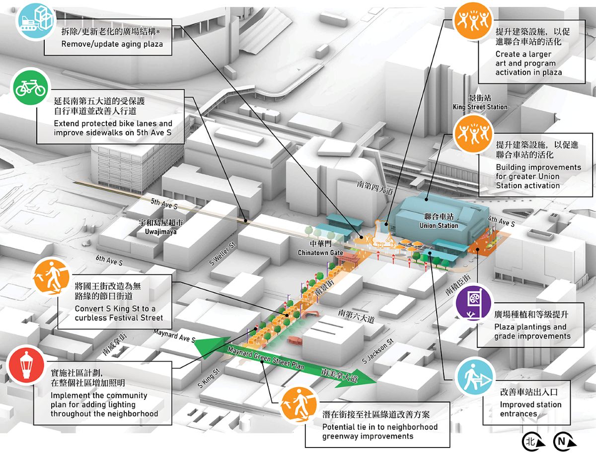
Concurrent with future SDOT and Sound Transit projects: 5 to 15 years
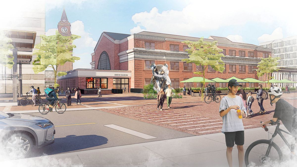
- IDS Plaza renovation: Remove dated structures; replace paving and station entry canopies; add lighting, art, furnishings, and new outdoor pedestrian link to 4th Ave S.
- 4th Ave S crosswalk at S King St: Add a new direct crossing to connect King Street Stations' Sounder entry to the Union Station Concourse.
- Union Station activation: Transform Union Station by adapting the Great Hall (winter garden and public programming), Concourse (café, concierge, vertical connection), Mezzanine (community offices/meeting areas), and Garden Level (flex youth recreation/performance area).
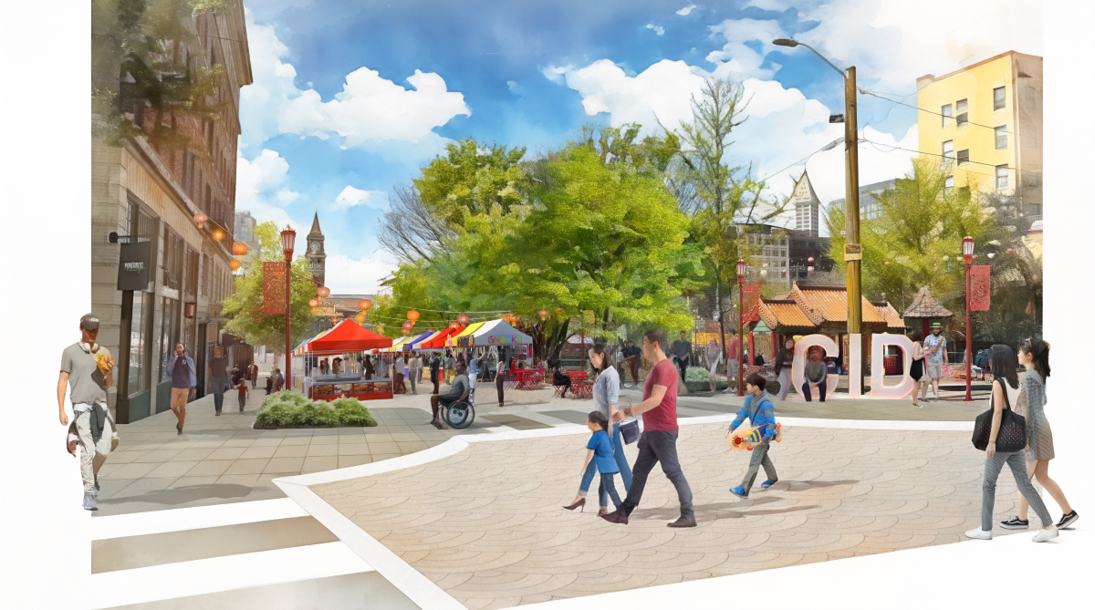
- King St festival street: Convert S King St to a curb-less, pedestrian-priority corridor with raised crossings, special paving, and event utilities which ties Union Station to Hing Hay Park and neighboring programming.
- 5th Ave S bike lane extension: Extend the existing protected bike lane south; close the right-turn slip from 5th Ave S to Seattle Blvd S to reduce conflicts.
- 4th Ave S improvements: Create a buffered pedestrian zone on the east side of 4th Ave S that provides comfort for people transferring between transit services.
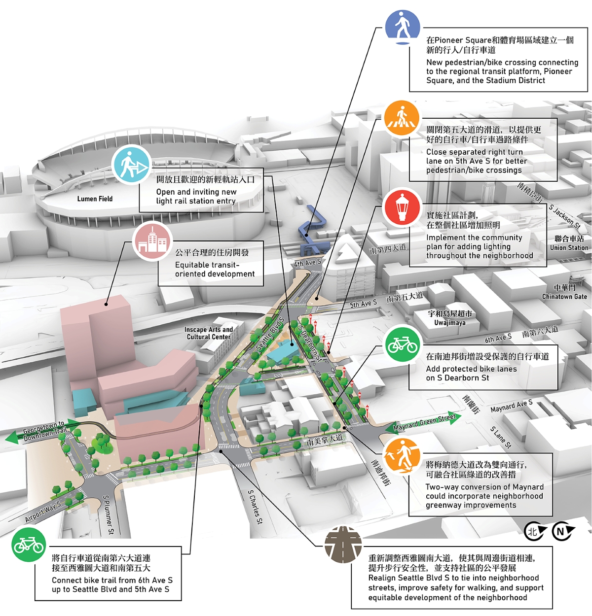
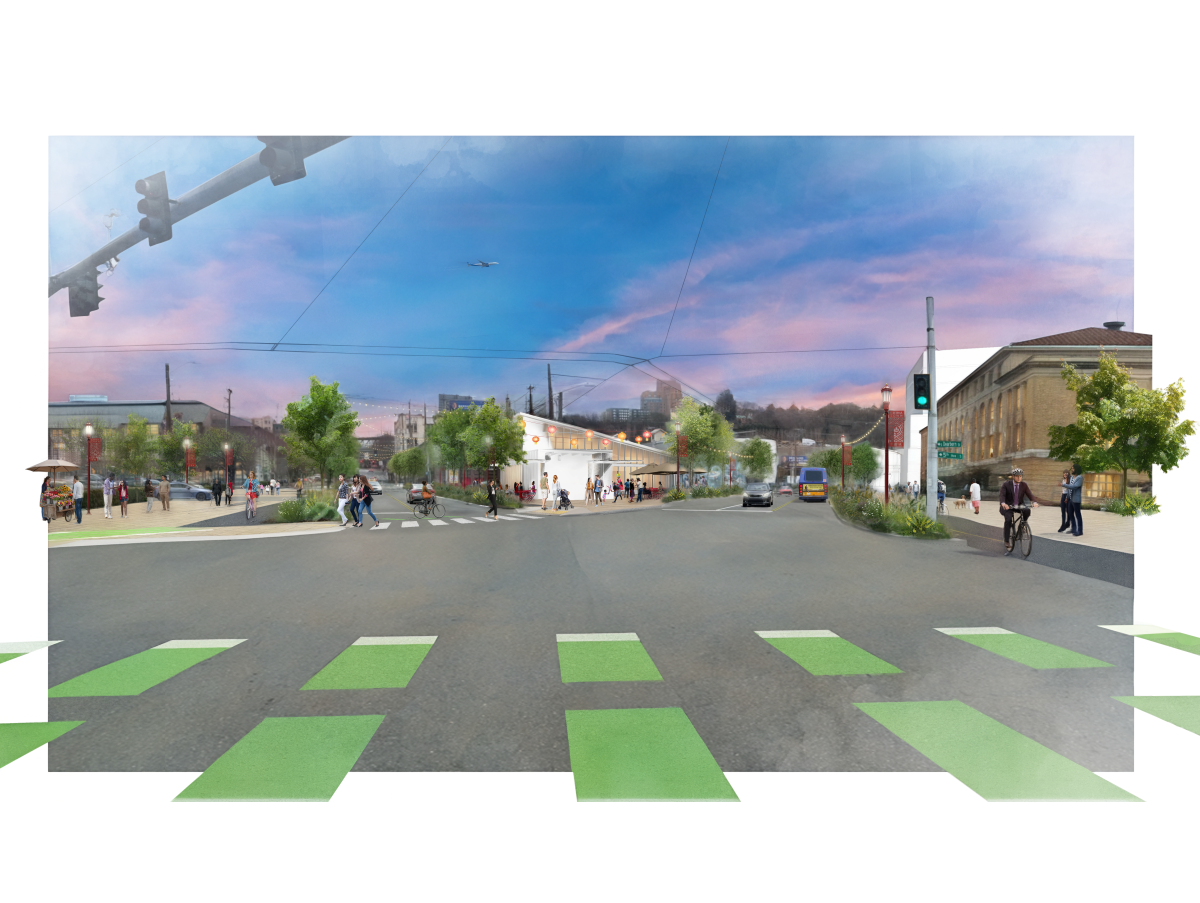
Concurrent with future SDOT and Sound Transit projects: 5 to 15 years
- 6th Ave S streetscape: Incorporate street upgrades with curb/sidewalk extensions, protected bike lanes, and greener frontage.
- S Dearborn St rechannelization and streetscape: Narrow the street and add all ages and abilities protected bike lanes, curb/sidewalk extensions, high-visibility crossings, new plantings, and pedestrian lighting.
- Seattle Blvd S Grid alignment: Realign Seattle Blvd to calm traffic, improve safety, and foster equitable transit-oriented-development (TOD) opportunities adjacent to potential new light rail station; includes protected bike facilities and pedestrian upgrades.
- Seattle Blvd S land use changes: Explore zoning changes, development agreements, and property acquisition to support equitable TOD around potential new light rail station.
Future major capital programs or developments: 15 or more years
- Seattle Blvd S pedestrian bridge: Create new pedestrian/ bike bridge linking the Sounder public access landing at 4th Ave S/ Seattle Blvd S to the Lumen Field entry plaza across BNSF.
- Seattle Blvd S cycle track: Add a two-way, protected facility along Seattle Blvd S, completing the corridor to the SODO trail.
- 6th Ave S trail: Rebuild the 6th Ave S trail leg of the SODO trail, coordinating with bike lanes and grid alignment to connect the trail northward.
5 to 15 years
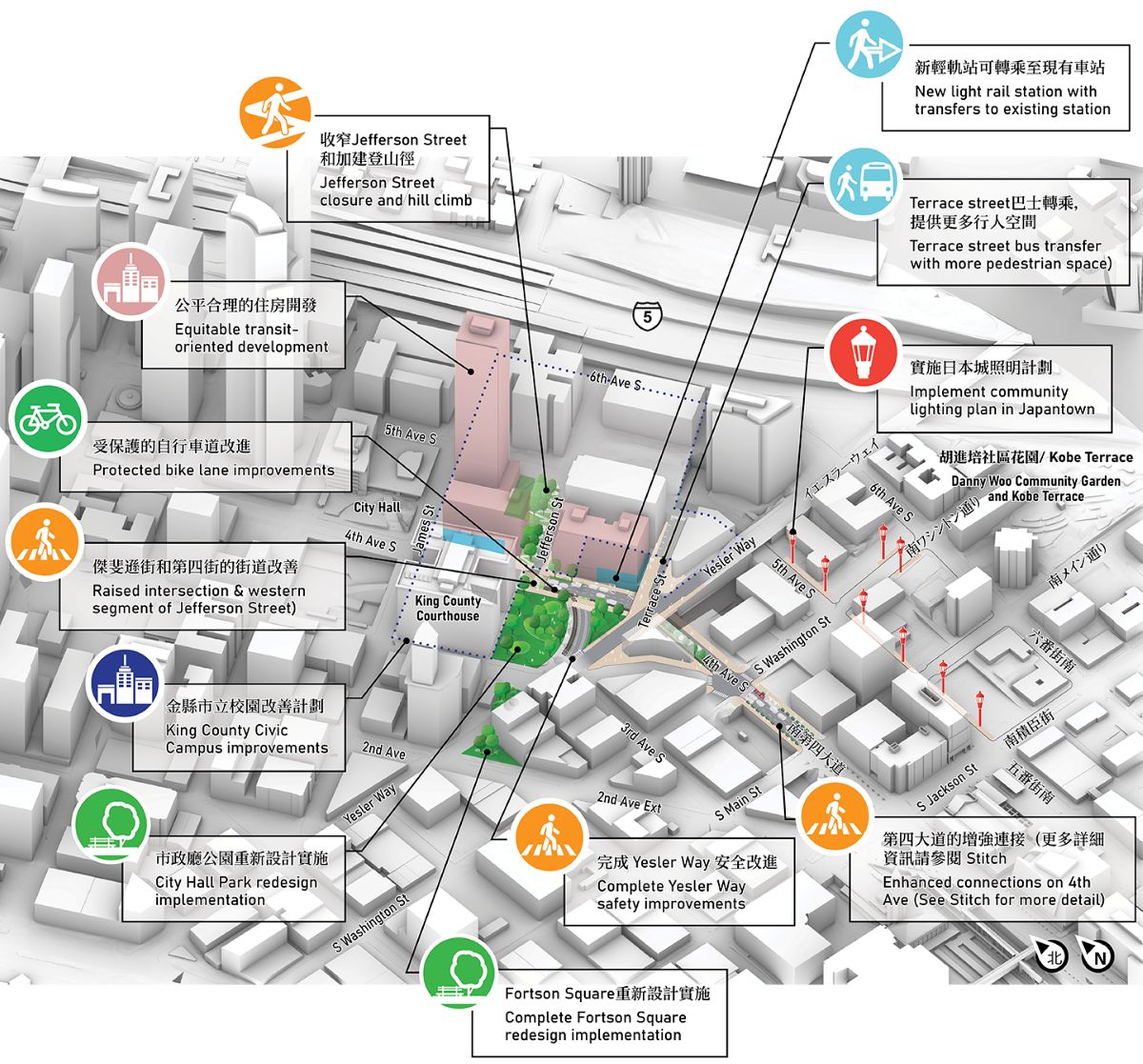
- Terrace St pedestrianization: Develop streetscape with curb extensions and eastbound, transit-only lanes that prioritize safe access to the King County Civic campus and light rail station.
- 4th Ave bike lane improvements: Create bike lane upgrades and adjust vehicle lanes to reduce conflicts and connect with 4th Ave improvements to the south.
15 or more years
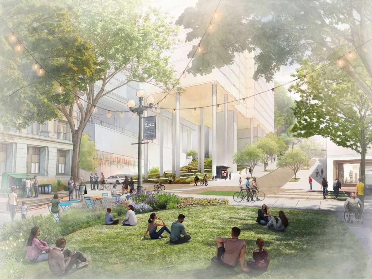
- Jefferson St streetscape: Reconstruct the streetscape with curb extensions and a raised crossing into City Hall Park; integrates an accessible hill climb.
- King County Civic Campus redevelopment: Transform underutilized civic properties into a mixed-use, mixed-income neighborhood integrated with public spaces.
Engagement process
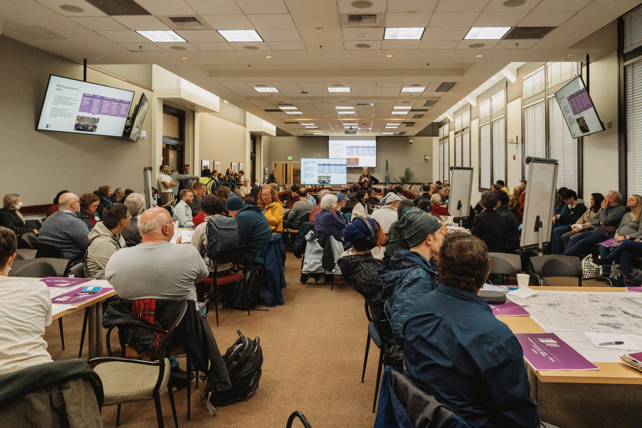
Community feedback helped shape the scope and direction of the South Downtown Hub Framework Plan. Throughout the planning process, we asked community members questions and to share their thoughts on opportunities, issues, and trade-offs, as well as how concepts might support neighborhood goals. Engagement methods were tailored to enhance public involvement, promote active community participation in decision-making processes, and foster inclusivity, transparency, and equitable outcomes for the final plan.
Primary in-person engagement methods included public open houses and workshops. For those unable to attend these events, we provided online surveys for virtual feedback, and displayed exhibitions in the Great Hall at Union Station for drop-in viewing and commenting. To supplement general engagement efforts, we held small group forums, meetings, and tours to reach residents, business owners and employees, community associations, and other CID and Pioneer Square community members with an interest in the development of the South Downtown Hub Framework Plan.
To remove barriers to participation and reach community members representative of the CID and Pioneer Square neighborhoods, we provided language interpretation in Cantonese, Mandarin, and Vietnamese during in-person events. Meeting materials in Simplified Chinese, Traditional Chinese, and Vietnamese were also available in-person and posted online.
Engagement highlights
Over 1,600 engagement impressions throughout the South Downtown Hub Planning Project
Engagement activities:
- 2 open houses with over 280 attendees
- 2 workshops with over 210 attendees
- 2 exhibitions with 318 definite interactions
- 2 online surveys with 623 responses
- 14 community meetings with 196 participants
- 20 newsletter notifications with 164,052 articles opened
SDH materials
- SDH Framework Plan:
[English]
[Traditional Chinese]
[Simplified Chinese]
[Vietnamese] - SDH Engagement Summary:
[English]
[Traditional Chinese]
[Simplified Chinese]
[Vietnamese]